 Contact us
SERVICES
- HD Map for Automated Driving
HD Map for Automated Driving
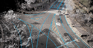
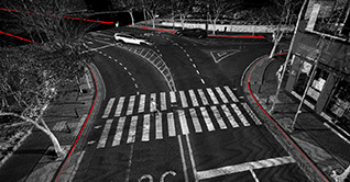
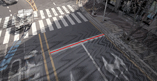
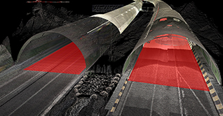
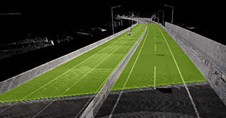
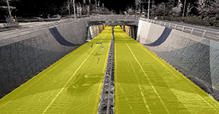
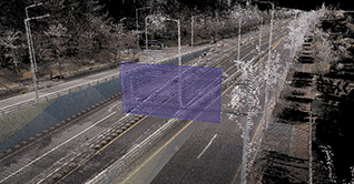
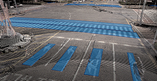
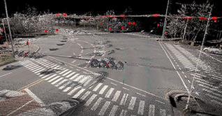
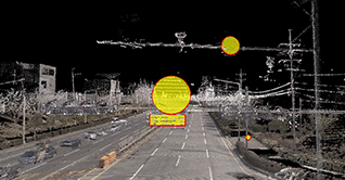
WAYS1 builds 3D spatial information of lanes, road facilities, and signages for automated driving.
Our HD map for automated driving integrates the information gathered from the in-vehicle sensors
in addition to roadside information outside the sensor range to enable vehicle location adjustment, route generation,
and safe lane change during automated driving.
Our HD map for automated driving integrates the information gathered from the in-vehicle sensors
in addition to roadside information outside the sensor range to enable vehicle location adjustment, route generation,
and safe lane change during automated driving.
Core data set
-
Lanes
- 1Lane Link
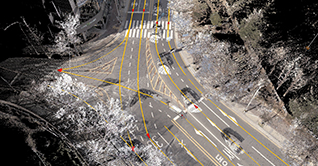
- 2Lane Side
- 3Road Edge
- 4Stop line
- 1Lane Link
-
Road facilities
- 1Median strip

- 2Tunnel
- 3Bridge
- 4Underpass
- 1Median strip
-
Signages
- 1Road Sign
- 2Road Mark
- 3Traffic Light
- 4Traffic Sign
- 1Road Sign
- WAYS1 Inc.CEO : Hwang Seung HoBusiness Number : 409-86-53561
- Head office : (16006) D-521, Indukwon IT Vally, 40 Imi-ro, Uiwang-si, Gyeonggi-do, Republic of Korea
- R&D Center : (13493) A-313, 240, Pangyoyeok-ro, Bundang-gu, Seongnam-si, Gyeonggi-do, Republic of Korea
- Tel. : +82-31-8069-7887Fax : +82-31-8069-7899E-mail : contact@ways1.com
Copyright© Ways1 Inc. All Right Reserved. Site By THREEWAY